Valid page link to bnasroberts.net - Baz’ Scenery http://www.bnasroberts.net/XPScenery/Welcome.html
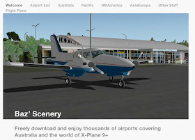
Note the opening page features a generic simulated aircraft they call X-Plane 9+. The developer has programmed "thousands of aiports" into the software to fly this plane to. He included air fields in Antarctica!

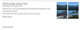
Just to give you an example of what this simulator offers, I picked out one package of software that allows to fly an accurately simulated flight around some islands on the Great Barrier Reef of Australia.
Here's the catalog description for it.

Here's the catalog page it was taken from. LINK: Flight Plans
http://www.bnasroberts.net/XPScenery/Flight_Plans/Flight_Plans.html
To save you the reader time, I clicked on the link for the FLIGHT PLAN that the software provides and it's stunningly accurate with latitudes and longitudes, place names, and nautical mile distances-- not to mention accurate digital pictures. The only missing element of this simulator are REAL pictures taken on location by REAL AIRCRAFT. That would take this simulator to a whole new level. But, I digress. I'll consider that option later since that's what will be required for Antarctica as ice rim vs. island. Look at the flight plan for the Great Barrier Reef as a way to understand the context of what we'll look for with the Antarctica flight plan coming up on this post.

SOURCE
http://www.bnasroberts.net/XPScenery/Flight_Plans/Entries/2014/1/26_Whitsunday_Island_Hop_files/Whitsundays%20Island%20Hop.pdf
http://www.bnasroberts.net/XPScenery/Flight_Plans/Entries/2014/1/26_Whitsunday_Island_Hop_files/Whitsundays%20Island%20Hop.pdf
With the format of the island hopping above in mind, we'll now consider the Antarctica flight pak for this simulator. Here's the catalog description.

The typeface is too light to read easily but it reads (in the Read more page)...
QUOTE
AntarcticaPak
This collection of 32 airports covers the Antarctic region.
Skiways in more isolated areas are variable in both location and runway length so there is an element of guess work based on data and investigation.
Some airports are positioned in the water. This could be blamed on global warming however it probably due to less than accurate terrain coverage.
Terrain coverage can be downloaded from: http://www.xpsrtm.com/
Click on maps to download .env files. This data is not available from the XP world scenery disks.
place your (Terrain) tiles folders in Global Scenery (folder): -global terrain- (folder) (XP9)
Requirements
Terrain for Antarctica: http://www.xpsrtm.com/
OpenSceneryX: http://www.opensceneryx.com/
UNQUOTE
I took a closer look at the source data for the flight simulator a xpsrtm.com and found a detailed description of where the data comes from. It's quite involved so I'll post it here again, since it's tricky to find the page. Here's the link.LINK: X-Plane SRTM scenery http://www.xpsrtm.com/
QUOTE
Why this site ?
All started after reading two articles (in PCPilot and in Microsimulateur) about X-Plane and it's poor terrain details. I was intrigued about how the terrain was modeled and discovered that it was true: a flat world with few bumps here and there ..
So I decided to look around on Internet for elevation data and have been quite surprised to discover so mutch data (quantity and quality). Just try on Google with the words: 'map terrain elevation data' and if you don't find the data you want ... sorry ...
For the data, it was ok (I will comeback later on the format and the accuracy of the data). Now that's the X-Plane scenery file format which was missing ... Google ... again and I landed on Ben Supnik site: www.xsquawkbox.net and found all I needed !
The Data
After playing with GTOPO30 data I came to SRTM data.
The diff ?
GTOPO30 is a global digital elevation model (DEM) with a horizontal grid spacing of 30 arc seconds (approx. 1 kilometer).
SRTM is a digital elevation model (DEM) with a horizontal grid spacing of 3 arc second (approx. 90m). For the SRTM data coverage check here. A 1 arc second data product also exists, but is not available (except for US).
What a diff !!!!!
For more info, see the 'Links' page.
I'm living in Belgium, Brussels to be exact. After a first round over Brussels I discovered that some main roads was also missing so I made another Google search and found the VMAP0 data.
Vector Map (VMap) Level 0 is an updated and improved version of the National Imagery and Mapping Agency's (NIMA) Digital Chart of the World (DCW®). The VMap Level 0 database provides worldwide coverage of vector-based geospatial data which can be viewed at 1:1,000,000 scale, i.e. 1cm=10km.
Ok, got all I needed but unfortunately with a source for the roads, rivers and others which was far less precise than the terrain elevation ..... If you know a better source drop me a mail.
Due to this difference you will sometimes get river or road not following the terrain ... oops !!!
If I can find a more precise data set I will update the files accordingly.
Than I wrote a code in order to extract the data and recreate the env file of X-Plane. I'm not an expert in coding so I decided to go with PHP (don't laugh please) and ended with a nice tool which does what I need: creating 'env' files with SRTM data and all main roads, rivers, railroad and others.
Outside SRTM coverage GTOPO30 data is used for the terrain elevation.
Enjoy downloading, using and modifying them :-)
Eddy.
UNQUOTE
Rick's comment: Note the references "Eddy" uses. They're official sources.
"National Imagery and Mapping Agency (NIMA).
"Digital Chart of the World (DCW)".
I'll drill down on NIMA and DCW later and deal with Eddy's simulator first. Here's a link to a google search on "national imagery and mapping agency"... and lo and behold we find that the USGS (United States Geological Survey) is heading that up. I pointed to USGS in an earlier blogpost somewhere noting that all map makers use USGS as a source-- and that USGS is a single official map source. If Antarctica were going to be faked as an island rather than an ice rim, then USGS is housing the team that is creating the deception. But again, I'll look at them later. Here's a google search if you'd like to start looking at them now.
LINK national imagery and mapping agency - Google Search

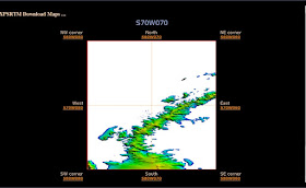
This is potentially fantastic. Note that the projection used is a "normal" "mainstream" "MERCATOR" projection, I think. I could be wrong. I don't know my projections. This just seems to be familiar and I know MERCATOR is out there. Let's do as Eddy suggests and click on a section to get a closer look. We'll start with ROTHERA which is a station on the peninsula run by the British.
Here's the Rothera area. I'm not sure if this is useful or not. I guess it is potentially useful but there are no placenames as I thought there might be. I'm not sure how this would be used. What struck me as I looked at this map, however, was the FINE PRINT BELOW it.....

Here's the fine print made large.
Notice: No warranty for the data located on this web site is given or implied; use them at your own risk. They are not to be used in real flight.
Isn't that interesting? Eddy wrote that he got the data from USGS, ultimately. Yet we're now told that this data can't be used in REAL flight. This is consistent with a FALSE representation of Antarctica by USGS, in my view. It's circumstantial but it's stunning. If all the data are gleaned from accurate sources, then why can it NOT be used for REAL missions? It can only be because it's WRONG. Here's a link to Eddy's site again for convenience if you'd like to look at it yourself.
LIVE LINK: X-Plane SRTM scenery
URL: http://www.xpsrtm.com/
Baz’ Scenery
Going back to the Robert's Simulator site....
LIVE LINK Baz’ Scenery
URL http://www.bnasroberts.net/XPScenery/Welcome.html
....we'll take a closer look at the RESULTS that BNASRoberts got from using Eddy's/USGS data for the simulator. Here is a list of the airports he created.
QUOTE
Airports
SAWB Base Marambio
AT02 Browning Pass
YCAY Casey Station
AT03 Concordia Station
AT04 D10 Skiway
AT05 D85 Skiway
AT07 Davis Plateau Skiway
AU12 Davis Station
AT09 Enigma Lake
AT10 Fossil Bluff Skiway
AT11 Halley Station Skiway
AT12 Kohnen Station Skiway
AT13 Mario Zucchelli Station
NZIR Mcmurdo Station Ice Runway
NZPG Mcmurdo Station Pegasus Field
AT14 Mid Point Skiway
AT15 Molodezhnaya
AT16 Neumayer Station Skiway
AT17 Novolazarevskaya
AT19 O'higgins Skiway
AT18 Odell Glacier
AT20 Plateau Station Skiway
AT01 Rothera Research Station
AT21 Rumdoodle Skiway
AT22 SanaeIv Skiway
AT25 Showa Station Skiway
AT23 Sitry Skiway
AT24 Sky Blu
SCRM Teniente Rodolfo Marsh Martin
AT26 Thiel Skiway
AT27 Troll Airfield
AT28 Vostok Station Skiway
(AT## represent new airports to XP that have no ICAO code)
UNQUOTE
That's an impressive list that seems to me to be more extensive than anything on wikipedia or anything I've seen yet. It appears accurate to me with familiar AND unfamiliar names. Interestingly, BNASRoberts (I still don't know what BNAS stands for but will continue to use the label for this simulator site-- to differentiate if from the OTHER simulator company Aerosoft)... Interestingly, BNASRoberts had to be ASKED to place those data points on a map-- here's his comment linked to the map...
QUOTE
Follow up...
I had a request for a map so here is a map and flight plan from west to east.
West to East.zip
UNQUOTE
I unzipped his file and found a map with all the coordinates. Imagine that. I wonder if USGS has as easy a public access to airport data like this for Antarctica? I'll check later. For now, here's BNASRobert's list of Antarctica airports, with Nautical Mile distances to the NEXT airport!

Source: pdf file on this page. LINK: AntarcticaPak
URL http://www.bnasroberts.net/XPScenery/Australia/Entries/2011/11/25_AntarcticaPak.html
And here's the map of those points.

Fantastic. Consider the first airport, Theil AT 26 to SkyBlu AT24... the very first to the second airport in the diagram above. Now consider the chart above. That chart says the "next" airport to Theil is 634 nuatical miles, the next one being Skyblu-- which from my previous research is merely a refueling station. I'm not yet familiar with what Thiel Skyway is, however-- so I'd have to look at that independently. There is only one relevent video on youtube for Thiel.
LIVE LINK
thiel skyway antarctica - YouTube
Here's the only video that comes under a search for Thiel AT24... and I'll finish this blog post with it because it's rather exciting-- watching a simulation of a landing at AT24 with some background music from a band that hasn't been named. There are no comments there yet but I'll post there so readers here can go there and talk music, among other things. The youtube comments sections are actually more useful to me than anything twitter or facebook ever offered. Youtube is the second most popular search engine in the world now second only to Google.
https://twitter.com/chrismichel/status/436670886024728578
ReplyDeleteChristopher Michel @chrismichel
The most remote gas station in the world. Thiel Mountains, Antarctica.
https://pbs.twimg.com/media/Bg9d23XCUAA9myh.jpg
5:17 pm - 20 Feb 2014
https://www.flickr.com/photos/cmichel67/11251773875/in/photostream/
C-GXXB refuelling at ?Thiel? en route for the Pole
https://www.flickr.com/photos/cmichel67/11251874953/in/photostream/
The plane is a Kenn Borek Twin Otter - usually fitted with floats in the Pacific NW
https://www.flickr.com/search/?text=c-gxxb
My browser won't support the flickr links. I added up the distance from Rothera to Thiel however-- and its about 1500 nm according to BnasRoberts info based on USGS. On a flat earth, the pole must be an agreed upon point they call pole but is actually a point on the perimeter, inland a certain ways from Mawson and Rothera. I don't see anyone going to the pole from the other side. It might be useful to watch for trips to the pole to see where they originate and watching where they refuel. Thiel is new to me-- I've never seen it on a map or referred to before BnasRoberts chart.
ReplyDelete